Mass unauthorized operations of consumer unmanned aerial vehicles (UAVs) within Temporary Flight Restriction (TFR) zones represent a critical breach of low-altitude airspace management. The execution of the 2026 FIFA World Cup across 11 United States host cities serves as a live stress test for domestic Counter-Unmanned Aerial Systems (C-UAS). The interception and seizure of more than 600 unauthorized drones by the Federal Bureau of Investigation (FBI) and the Department of Homeland Security (DHS) reveals a widening discrepancy between public regulatory compliance and automated interdiction capabilities.
Evaluating this mass enforcement action requires moving past raw incident counts to analyze the specific mechanics of modern low-altitude security: radio frequency (RF) spectrum manipulation, the asymmetry of pilot-to-device tracking, and the structural friction between local, federal, and international regulatory frameworks. In similar developments, take a look at: Why Diaspora Protests Will Never Save Pakistan Occupied Kashmir.
The Triad of Low-Altitude Airspace Interdiction
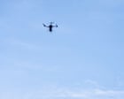
Defending open-air stadiums against commercial, off-the-shelf drones relies on a continuous operating loop of three interconnected phases: passive discovery, active identification, and hard or soft mitigation. When a drone crosses a TFR boundary—defined by the Federal Aviation Administration (FAA) as extending three hours before and three hours after scheduled matches—the counter-drone infrastructure must resolve the vector within a compressed decision window.
Passive RF and Radar Discovery
The foundational layer of stadium airspace defense relies heavily on multi-spectral sensor arrays. Radio frequency scanners monitor common industrial control frequencies—primarily the 2.4 GHz, 5.8 GHz, and emerging Wi-Fi broadcast bands. These scanners capture the uplink commands from the ground controller and the downlink telemetry from the aircraft. BBC News has provided coverage on this critical issue in extensive detail.
Urban stadium environments generate severe RF noise from thousands of consumer mobile devices, media broadcast trucks, and local emergency infrastructure. To overcome this noise, C-UAS arrays utilize directional antennas and cognitive radio algorithms to filter out ambient interference and isolate the specific frequency-hopping spread spectrum signals characteristic of commercial drone protocols.
When a drone employs encrypted or proprietary communication protocols that evade standard RF libraries, the system switches to micro-Doppler radar networks. Micro-Doppler systems track the unique physical rotation signatures of small drone propellers, separating low-flying UAVs from biological targets like birds or environmental clutter such as wind-blown debris.
Optical and Thermal Verification
Once an anomaly is flagged via RF or radar detection, automated pan-tilt-zoom camera systems equipped with high-definition optical and long-wave infrared sensors track the target coordinate. This phase is vital for classifying the threat vector. It determines the payload capacity of the airframe, the presence of modified modifications, and whether the drone is a fixed-wing craft or a multi-rotor platform.
Signal Manipulation and Kinetic Mitigation
The final element of the triad involves neutralization. In civilian-dense areas, kinetic interdiction—such as projectile netting, shotguns, or high-energy lasers—presents a severe secondary hazard due to falling debris or unguided kinetics. Consequently, federal teams deploy soft-kill mitigation strategies. These involve precise signal disruption, targeting the Global Navigation Satellite System frequencies used by the drone for positioning, or taking over the command link protocol to force the aircraft into an automated safe-landing sequence or a return-to-home routine.
Geographical Distribution and Structural Bottlenecks
The seizure data collected since the tournament's commencement on June 10 indicates that drone activity is highly concentrated around specific urban layouts and regional infrastructure types.
| Host City Sector | Documented Drone Seizures | Primary Architectural Vulnerability |
|---|---|---|
| Miami | 99 | Open coastal approaches and high-rise line-of-sight launch platforms |
| Miami (alternate data point) | 98 | Open coastal approaches and high-rise line-of-sight launch platforms |
| Atlanta | 77 | High urban density and complex structural RF reflections |
| Dallas | 63 | Expansive parking footprints and open suburban horizontal visibility |
| Los Angeles | 48 | Distributed perimeter zones and multiple highway transit corridors |
| New York | 40 | Highly congested airspace corridors and dense commercial RF noise |
| Houston | 33 | Large industrial flatlands and suburban perimeter access points |
| Kansas City | 32 | Open stadium topography with minimal natural perimeter shielding |
| Seattle | 29 | Hilly terrain variations causing distinct radar blind spots |
| Newark | 9 | Tight integration with major international commercial airport approaches |
Analyzing this distribution reveals that the physical architecture of a host city dictates the rate of drone incursions. The high volume of seizures in Miami highlights the tactical challenge of securing venues bordered by open water and elevated structures. High-rise buildings provide unauthorized pilots with elevated launch platforms that extend their line-of-sight control, effectively bypassing ground-level physical perimeters and complicating local tracking efforts.
Conversely, the low volume recorded in Newark stems directly from its proximity to major commercial aviation infrastructure. The existing, heavily enforced airspace protections surrounding international airports act as a strong deterrent, and consumer drone firmware often includes built-in geofencing that automatically blocks operation in these sectors.
The data reveals a stark contrast between suburban venues and dense urban environments. While open-top suburban stadiums allow radar and optical sensors to track threats across long distances, they also give unauthorized pilots thousands of potential launch points along highways and parking lots. Urban venues reduce these long-range launch options but introduce severe signal reflection issues, where radar and radio signals bounce off concrete and steel structures to create ghost targets.
The Asymmetry of the Pilot Localization Problem
A core problem in counter-UAS operations is the fundamental imbalance between intercepting an airborne drone and apprehending its operator on the ground. Intercepting the drone requires neutralizing a slow-moving, radio-emitting target within a small, controlled airspace. Locating the operator, however, requires scouring a sprawling, complex urban environment in real time.
+------------------------------------------+
|          Active Drone Detection          |
|  (RF Scanning, Radar, Optical Tracking)  |
+------------------------------------------+
                     |
                     v
+------------------------------------------+
|       Telemetry Stream Extraction        |
|  (Isolate Control Signal & Data Uplink)  |
+------------------------------------------+
                     |
                     v
+------------------------------------------+
|        Operator Vector Demarcation       |
|  (Triangulate Transmitter Coordinates)   |
+------------------------------------------+
                     |
                     v
+------------------------------------------+
|    Ground Intercept Team Dispatch        |
|  (Local Police / Federal Agents Route)   |
+------------------------------------------+
When a drone is detected, C-UAS systems attempt to extract the telemetry stream to identify the operator's real-time position. If the control signal is successfully decoded, the system can pinpoint the precise GPS coordinates of the handheld transmitter. If the transmission link is encrypted or obfuscated, ground enforcement teams must rely on radio-frequency direction finding. This process uses multiple ground sensors to triangulate the transmitter's location based on signal strength and arrival time.
Once the coordinates are established, field agents must navigate traffic, crowds, and physical barriers to reach the pilot before the flight ends. Consumer drone batteries typically last between 20 and 40 minutes, creating a very narrow window for ground interception. If the pilot operates from a moving vehicle or quickly packs up the equipment after a short flight, the chances of an arrest drop significantly. This reality explains why the 600 seized drones have led to relatively few federal prosecutions; the physical evidence is easily captured, but the operators frequently escape into the crowd.
Legal Frameworks and the Limits of Enforcement
The legal tools used to manage the airspace during major sporting events rely on a mix of administrative fines and criminal charges. The FAA establishes Temporary Flight Restrictions under federal law, making it illegal to operate an aircraft—including consumer drones—within a designated radius of a stadium, typically three nautical miles, from three hours before kickoff until three hours after the match concludes.
The penalties for violating these TFR zones are severe:
- Administrative Civil Fines: The FAA can issue penalties up to $75,000 per violation for unauthorized drone flights in restricted airspace.
- Criminal Prosecution: Violators face federal criminal fines up to $100,000 and up to one year in federal prison.
- Asset Forfeiture: The hardware involved, including the drone, camera payloads, and control systems, is subject to immediate seizure and permanent forfeiture.
- Licensing Sanctions: For certified commercial remote pilots, violations result in the immediate revocation of their part 107 airman certificate.
Despite these strict penalties, the high number of incursions during the tournament points to a clear deterrence gap. Most consumer drone operators are casual hobbyists who do not check official aviation notices or understand TFR designations. Because they lack formal aviation training, these operators remain unaware of the legal risks until their equipment is intercepted.
Furthermore, enforcement faces structural limits due to the division of legal authority under U.S. law. While local police departments are usually the first to spot a drone, federal law strictly limits the authority to intercept or disrupt an airborne drone to specific federal agencies, primarily the DOJ and DHS. Local police lack the legal authorization to jam radio frequencies or use cyber tools to take over an aircraft, as these actions can conflict with federal wiretapping and computer fraud laws. This creates a critical operational bottleneck, requiring seamless, real-time coordination between local spotters and federal mitigation teams to legally neutralize a threat.
Security Tiers and the Integration of Federal Resources
The level of security and funding allocated to a venue depends heavily on its official federal designation. Throughout the tournament, the Federal Emergency Management Agency (FEMA) has provided $625 million to support security and emergency preparedness across all host venues. However, the operational footprint shifts dramatically when a venue receives the highest level of federal security status.
For the upcoming final match at MetLife Stadium in East Rutherford, New Jersey, the federal government has designated the event as a National Special Security Event (NSSE). This shifts the command structure from a collaborative local-federal effort into a highly structured operation led by the United States Secret Service, with the FBI managing counter-terrorism and intelligence collection, and FEMA coordinating emergency logistics.
An NSSE designation changes the airspace defense model in several distinct ways:
Hardened Physical and Technical Perimeters
The outer security zone expands significantly, moving the detection perimeter well beyond the standard three-nautical-mile TFR. Specialized military-grade radar arrays and long-range electronic warfare tools are deployed to detect and identify potential airborne threats long before they approach the venue.
Centralized Command Architecture
All security data, including radar feeds, RF tracking, and video streams, is funneled into a single Multi-Agency Command Center. This eliminates the communication delays that can hamper standard operations, allowing tracking data to flow instantly from federal sensors to tactical interception teams on the ground.
Active Electronic Warfare Authorization
Under the NSSE framework, federal teams are granted broader authority to use advanced electronic countermeasures. This includes deploying wide-band jamming systems and protocol-level takeover tools that can instantly neutralize multiple targets simultaneously, providing a robust defense against potential coordinated drone incursions.
Outside of NSSE-designated matches, individual host cities must rely on standard, pre-deployed federal drone mitigation teams. While these teams are highly capable, they operate with fewer resources and face greater coordination challenges when moving between local jurisdictions and distinct stadium properties.
Strategic Operational Recommendations
Managing low-altitude airspace at major public events requires shifting from a reactive posture to a proactive, integrated defense strategy. Relying solely on intercepting individual drones after they enter restricted airspace creates an unsustainable operational burden and leaves venues vulnerable to coordinated activity. Airspace security managers should implement the following structural updates to improve enforcement efficiency:
- Automate the Operator Localization Process: Security agencies should integrate automated RF direction-finding networks directly with local law enforcement dispatch systems. Automatically routing the coordinates of a drone pilot to the nearest ground patrol eliminates the delays caused by manual interagency communication, significantly increasing the probability of an arrest before the aircraft lands.
- Implement Preemptive Geofencing Updates: Federal authorities should coordinate directly with major drone manufacturers to push temporary, mandatory firmware updates that restrict flight within upcoming TFR zones. Blocking operations at the software level before an event begins prevents casual hobbyists from launching drones, allowing security teams to focus exclusively on deliberate, malicious threats.
- Establish Unified Local-Federal Legal Protocols: Congress should create a clear, standardized framework that allows trained state and local law enforcement officers to use specific, non-destructive counter-UAS technologies under direct federal supervision. Granting local agencies the authority to assist with initial tracking and soft-kill mitigation reduces the burden on federal teams and ensures a faster, more agile response to airspace violations.