The Fixation on Map Lines
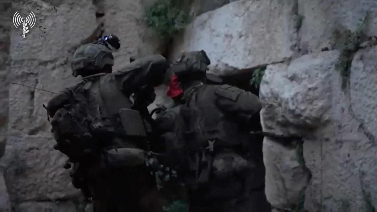
The international press is hyperventilating over a map line. When Israeli armor rolled up to the ancient stones of Chamaa Castle, five kilometers deep into southern Lebanon, the headlines practically wrote themselves. "Deepest incursion in 26 years," they screamed. The consensus formed within minutes: this was a massive tactical leap forward, a symbolic shattering of defensive lines, and a definitive shift in the conflict’s geography.
It is a neat, clean, and entirely hollow narrative.
Measuring success in modern asymmetric warfare by how many kilometers a tank column advances is like measuring the quality of a software update by how many gigabytes it takes up. It is a metric designed for a bygone era of industrial, state-on-state warfare, applied lazily to a conflict that operates on completely different physics.
I have watched analysts fall into this trap for two decades. They treat old Crusader forts like they are pieces on a Risk board. But holding high ground for a photo op is not the same as controlling the battlespace. In fact, celebrating a five-kilometer push as a monumental milestone ignores the brutal reality of how modern attrition works.
The Strategic Red Herring of Geography
The obsession with the "deepest incursion" narrative reveals a fundamental misunderstanding of the adversary's doctrine. Militias in southern Lebanon do not fight like NATO armies. They do not rely on a rigid, forward-deployed defensive line that, once breached, collapses the entire rear guard.
The Defensive Framework
- Decentralized Cells: The defensive structure is built on autonomous, highly localized units. The loss of a single village or a prominent hilltop does not trigger a systemic collapse.
- Subterranean Infrastructure: Control is not established on the surface. A ridge can be visually occupied by one force while the subsurface network remains entirely viable for the other.
- Asymmetric Tolerances: The adversary does not need to hold the castle to win; they just need to ensure the cost of holding it becomes unsustainable for the occupying force.
When you look at the mechanics of the Chamaa push, the conventional wisdom falls apart. Forcing a wedge five kilometers deep creates an elongated, vulnerable logistics tail. It multiplies the surface area exposed to anti-tank guided missile (ATGM) ambushes and short-range mortar fire.
Imagine a scenario where an army measures its corporate success solely by opening retail branches in hostile territory, without securing the supply chains or checking if the local market is actively trying to burn the buildings down. That is what celebrating a shallow penetration into a prepared zone of attrition looks like. It is a liability masquerading as an asset.
Dismantling the Symbolic Victory Myth
The media loves a symbol. A historic castle makes for great television. It implies dominance, historical continuity, and a crushing psychological blow to the defender.
This is a profound misreading of the psychological landscape. In asymmetric conflicts, letting an occupying force advance into a specific, identifiable choke point is often a deliberate choice. It concentrates the target.
"Geography is a cheat code only if you can afford to hold it indefinitely. If you cannot, it becomes a cage."
💡 You might also like: The Humanitarian Data Trap Why Counting Hospital Attacks Solves Nothing
Let's look at the numbers the mainstream analysis ignores. During the 2006 conflict, the heaviest armor losses did not occur during the initial border skirmishes; they occurred when conventional forces pushed deep into valleys like Salouqi, getting trapped in topographical bottlenecks. The current focus on deep incursions assumes the objective is territorial conquest. If the actual objective is degrading rocket launch capabilities, sitting on a historic hill five kilometers north of the border does almost nothing to alter the trajectory of a threat that originates dozens of kilometers further inland.
The Real Metrics of Attrition
If map lines are a useless metric, what actually matters? To understand who is winning or losing this confrontation, you have to look past the territorial banners and focus on three specific variables.
1. The Interdiction Rate vs. Launch Volume
The primary strategic goal of any northern push is to stop the fire raining down on civilian centers. If an army advances five kilometers, ten kilometers, or twenty kilometers, but the daily volume of rocket and drone launches remains static or increases, the geographic advance is a failure. The depth of the incursion is irrelevant; the neutralization of the trajectory capacity is everything.
2. The Logistics-to-Combat Ratio
Every kilometer deeper an army moves requires an exponential increase in support personnel, armored ambulances, fuel convoys, and active protection systems just to maintain the status quo. When the ratio of logistics protection to actual combat operations skews too heavily toward self-defense, the offensive loses all momentum.
3. The Reconstitution Velocity
Can the defender replace its local tactical commanders and assets faster than they are being eliminated? In a decentralized network, the answer is almost always yes. A conventional army spends massive institutional energy capturing a physical point, while the network simply pivots its communication nodes to the next valley over.
The Flawed Premise of the 26-Year Benchmark
Every report made sure to mention that this was the deepest push since 1998. This benchmark is intentionally misleading. It implies a linear progression of capability, suggesting that because the military has reached this point, it is somehow more successful than previous iterations.
This ignores the structural shift in the region's geography over the last quarter-century. In 1998, the conflict was defined by a permanent security zone with fixed outposts. Today, the entire region is a fluid, weaponized landscape where the distinction between "frontline" and "rear" has been entirely erased by technology. A drone can strike a command post ten miles behind the forward edge of troops just as easily as an ATGM can hit a tank on the border.
Citing the 26-year metric is a cheap shortcut used by commentators who do not want to do the hard work of analyzing modern tactical realities. It sounds impressive to a general audience, but to anyone who understands the mechanics of low-intensity conflict, it is entirely meaningless noise.
The Vulnerability of Selected Ground
There is a distinct downside to my counter-argument that must be acknowledged. Pulling back from a geographic analysis means you have to rely on highly opaque data—attrition rates, supply chain integrity, and intelligence intercepts that are rarely made public in real-time. It is much harder to write a daily column based on the fluctuating efficiency of radar interception algorithms than it is to point at a map and say, "Look, they took the castle."
But leaning on the easier metric leads to catastrophic policy and analytical failures.
When you rush to declare a strategic milestone because a flag was raised over a ruin, you misjudge the sustainability of the entire campaign. You create an expectation of victory based on real estate, setting up a political backlash when those forces eventually have to withdraw because holding a symbolic hilltop offers zero long-term military utility.
The hard truth is that capturing Chamaa Castle is not a sign of impending victory. It is the beginning of the most dangerous phase of conventional operations: trying to stay there.