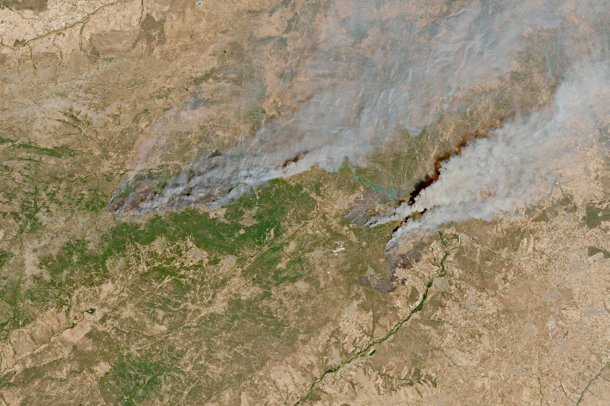
Massive, aggressive wildfires have scorched hundreds of thousands of hectares across France and Spain, forcing over 325,000 residents and tourists to flee active fire zones near Bordeaux and Madrid. Driven by record-breaking June heatwaves, tinder-dry vegetation, and extreme wind patterns, these blazes have transformed swathes of southwestern Europe into active war zones. While basic map aggregators track the burnt acreage, they consistently fail to report the underlying systemic failures of modern fire management policies, resource distribution, and land use planning across the Mediterranean.
The Geography of Destruction
The current emergency is concentrated in two primary theaters. In southwestern France, the Gironde department has turned into a nightmare. The Cap Ferret peninsula and surrounding forest zones west of Bordeaux have faced mandatory evacuations village by village. Flames leaping up to ten meters high have consumed more than 42,000 hectares in Gironde alone, making it one of the largest mainland burn zones in modern French history.
Across the border in Spain, the crisis is equally severe. A colossal fire originating near Ávila and moving toward the outskirts of Madrid has burned tens of thousands of hectares, prompting the central government to declare an unprecedented national emergency. Additional fronts have ignited near Valencia and other coastal areas, pushing civil protection agencies past their absolute breaking point.
Maps show the perimeter. They do not show the human cost or the operational paralysis on the ground.
Why Standard Firefighting Models Are Collapsing
For decades, European civil defense strategies relied on a reactive model. Ground crews and aerial water-bombers attack ignition points quickly, hoping to suppress blazes before they breach containment lines. That model is dead.
Modern extreme fires possess a terrifying thermodynamic property. They generate their own localized weather systems.
When a fire burns with sufficient intensity, it creates a firestorm characterized by pyrocumulonimbus clouds, erratic wind shifts, and flying embers that ignite new fires kilometers ahead of the main front. French Interior Ministry officials noted that the Gironde blaze began advancing erratically at speeds that completely outpace traditional tactical responses. When a fire moves faster than standard ground evacuation or suppression capabilities, traditional lines on a map become meaningless lines in the sand.
Fire behavior analysts point to a compounding factor: thermal inertia. Successive heatwaves bake moisture out of the soil and vegetation weeks ahead of historical averages. Pine forests, historically managed for timber and commercial resin, create dense, highly combustible monocultures. When these zones catch fire, they release an extraordinary amount of thermal energy that renders standard chemical retardants and water drops largely ineffective.
The Land Use Dilemma
Politicians love to blame the weather alone. It is an easy deflection.
The deeper vulnerability is structural. Decades of rural depopulation across the European interior mean fewer people are working the land, grazing livestock, or clearing underbrush. Historically, small-scale farming and localized animal husbandry acted as natural firebreaks. As rural communities shrank, agricultural lands reverted to unmanaged scrub and dense pine plantations.
Wildfire experts have argued for years that prevention requires active, labor-intensive forestry management, including controlled burns during cooler months and mechanical thinning of undergrowth. Budgets, however, remain heavily skewed toward emergency suppression rather than long-term prevention. Governments spend billions buying heavy water-bombing aircraft after the forest is already ablaze, while local forestry departments are chronically underfunded.
Logistics Under Fire
Evacuating hundreds of thousands of people from coastal tourist hotspots and mountainous interior towns introduces massive logistical friction. In the Gironde, thousands of summer tourists found themselves trapped as fire threatened the sole access routes off the Cap Ferret peninsula, requiring emergency extractions by commercial and military boats.
Local infrastructure was never designed for mass maritime or sudden highway evacuations under toxic smoke conditions. Road networks clog instantly. Mobile emergency alert systems push notifications to hundreds of thousands of devices simultaneously, occasionally causing localized panic and gridlock on narrow regional roads.
Hospitals and temporary reception centers set up in Bordeaux and Madrid are straining under the influx of displaced families and individuals suffering from acute smoke inhalation. Air quality across southern Europe has plummeted, forcing vulnerable populations indoors while emergency services battle to establish perimeter controls before the next anticipated heatwave spike.
The crisis sweeping France and Spain is no longer an anomaly to be managed with seasonal reinforcements. It is a structural failure of a continent waking up too late to an altered climate reality, trapped between antiquated forestry models and fires too ferocious to tame.