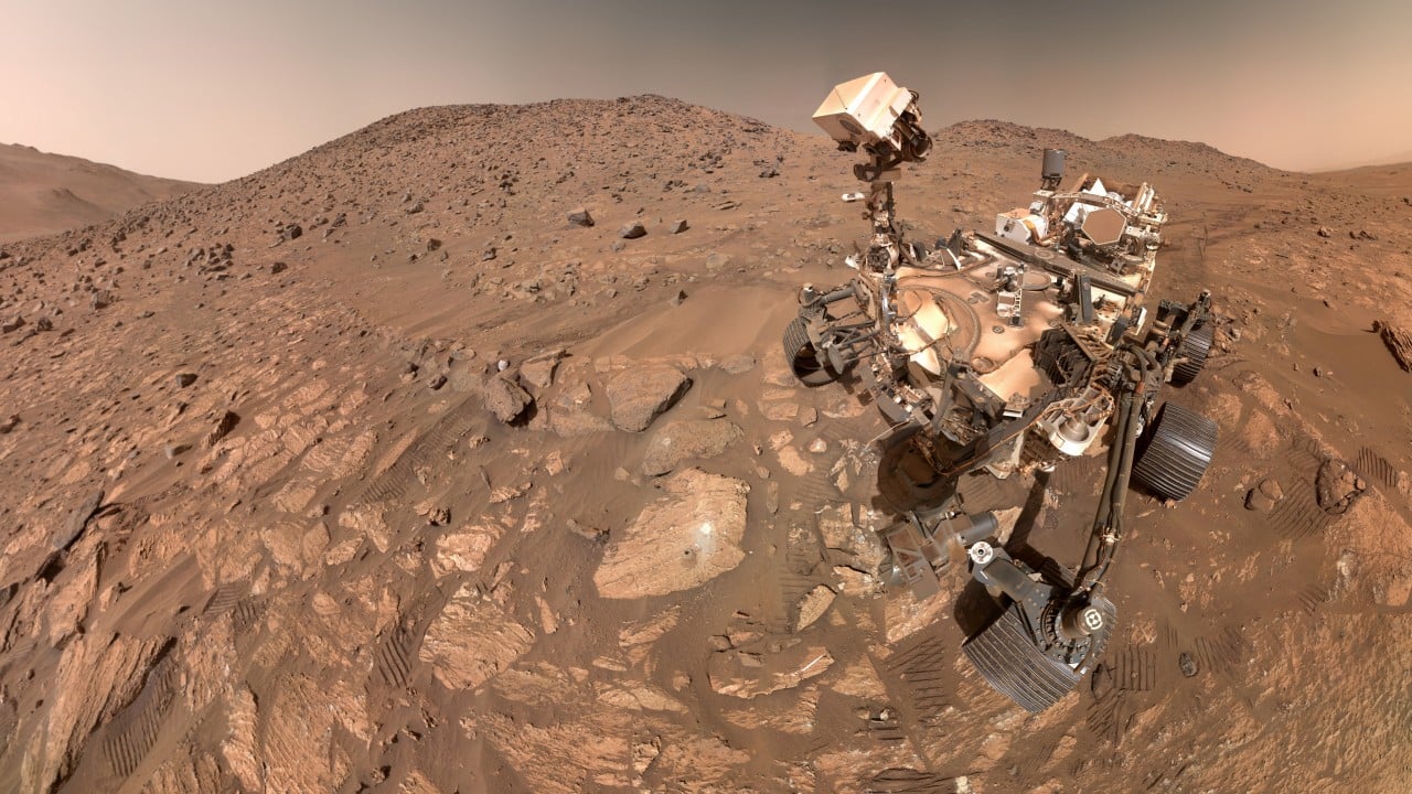
Autonomous surface operations on celestial bodies are bounded by a fundamental operational bottleneck: light-speed latency prevents real-time teleoperation, shifting the burden of trajectory optimization entirely to on-board computation. When the Mars 2020 mission’s Perseverance rover establishes a new off-planet driving record, the underlying engineering significance lies not merely in the gross distance covered, but in the efficiency of the autonomous pathfinding architecture that enabled it. Scaling off-planet mobility requires decoupling traverse distance from human-in-the-loop intervention, transforming navigation from a reactive telepresence task into a proactive, algorithmically governed optimization problem.
The Architectural Shift from Teleoperation to Autonomy
Traditional planetary rovers operated under tight operational constraints dictated by ground-in-the-loop command cycles. Operators on Earth received telemetry, identified hazards, planned a waypoint path, and transmitted a command sequence. This process yielded low daily traverse speeds because the rover spent significant fractions of its mission lifecycle idling while awaiting instructions or processing sparse environmental data.
Perseverance alters this cost function through AutoNav, an upgraded autonomous navigation system that integrates real-time stereoscopic vision processing with dedicated hardware acceleration. By running hazard detection and path planning concurrently with wheel motion, the rover eliminates the latency penalty.
[Ground Command] ──> [Latency Delay (Minutes to Hours)] ──> [Sparse Execution]
[On-Board AutoNav] ──> [Real-Time Hazard Detection] ──> [Continuous Micro-Routing]
The system continuously captures stereoscopic image pairs, constructs a local digital elevation model (DEM), and evaluates traverse costs across a grid of potential headings. The cost function weighs multiple variables:
- Terrain steepness and slope thresholds
- Rock abundance and geometric hazard height
- Wheel slip estimation based on slip-sinkage physics
- Energy expenditure per meter traveled
By evaluating these variables at the edge, Perseverance navigates complex terrain features—such as sand ripples, boulder fields, and steep crater walls—without requiring round-trip communication with Earth-based flight controllers for every tactical diversion.
Quantifying Off-Planet Traverse Efficiency
To evaluate a distance record objectively, mobility engineers rely on specific operational metrics that normalize raw linear progress against environmental impedance.
- Autonomous Drive Ratio: The proportion of total wheel rotation governed by on-board algorithms versus explicit ground-commanded vectors. Maximizing this ratio reduces the tactical workload on terrestrial operations teams and increases total drive time per sol.
- Path Deviation Index: The ratio of actual surface track length to the straight-line displacement between start and end coordinates. High deviation indicates excessive obstacle avoidance maneuvers; low deviation signifies efficient global path planning through rugged terrain.
- Slip-to-Progress Coefficient: A measure of tractive efficiency, calculated by comparing wheel revolution telemetry to actual displacement via visual odometry. Martian regolith exhibits variable cohesion, causing severe slip on loose slopes. AutoNav mitigates this by dynamically adjusting steering angles to maintain traction within safe operational envelopes.
When Perseverance sets a new distance benchmark, it validates the resilience of these predictive models under actual atmospheric and geological stresses. The rover’s ability to maintain high autonomous drive ratios across rough Jezero Crater floor units demonstrates that the onboard perception-action loop can effectively generalize unseen terrain hazards.
Algorithmic Bottlenecks in Planetary Pathfinding
Despite advancements in on-board computing, edge navigation on Mars presents unique computational constraints. Space-qualified processors must operate under strict power envelopes and endure high-radiation environments, limiting raw clock speeds compared to terrestrial systems. Consequently, pathfinding algorithms must balance geometric precision with computational tractability.
The local planning architecture typically employs a variant of Dynamic Window Approaches or lattice-based planners. The rover projects a set of possible curvature and velocity trajectories over a short time horizon, simulates the kinematic response against the digital elevation model, and selects the optimal trajectory that minimizes a weighted sum of distance to goal, hazard penalty, and roughness.
Terrain Input (Stereo Vision)
       │
       ▼
Digital Elevation Model (DEM) Generation
       │
       ▼
Trajectory Lattice Projection (Kinematic Simulation)
       │
       ▼
Cost Function Evaluation (Slope, Slip, Hazards)
       │
       ▼
Optimal Heading Execution
When rock density increases beyond critical thresholds, the search space complexity scales non-linearly. If the local planner encounters a trap—such as an impenetrable amphitheatric depression—it must trigger a fallback behavior, reversing out of the local minimum and recalculating a global waypoint graph. Minimizing the frequency of these recovery behaviors is the primary determinant of long-term traverse velocity.
The Scaling Limits of Surface Mobility
While autonomous driving records illustrate significant engineering maturity, absolute distance scaling on Mars remains bounded by mechanical and thermal constraints rather than pure algorithmic capacity.
- Thermal Dissipation: Continuous motor operation generates internal thermal loads. Gearboxes and actuator windings must remain within tight operating brackets to prevent lubricant breakdown or thermal expansion lockup.
- Power Budgets: Radioisotope thermoelectric generators (RTGs) provide a stable, yet strictly limited, baseline power output. High-speed autonomous driving demands simultaneous high power draw from drive actuators, hazard-avoidance camera systems, and onboard navigation processors, depleting energy reserves faster than ambient environmental charging allows.
- Wheel Degradation: Thin aluminum wheels are susceptible to puncturing and structural fatigue when traversing sharp, unweathered basaltic rocks. While wheel wear can be mitigated by optimizing path selection to avoid high-stress contact geometries, mechanical fatigue remains a hard physical limit on total mission lifetime mileage.
Operational Execution for Autonomous Traverse Campaigns
To sustain high-efficiency driving over extended mission horizons, flight software and tactical operations teams must continually refine the interaction between global strategic routing and local reactive autonomy.
- Prioritize Orbital Reconnaissance Integration: Feed high-resolution orbital imagery into onboard neural networks to pre-classify regional terrain units before the rover enters visual range, reducing the computational overhead of real-time geometric segmentation.
- Dynamic Cost Weighting: Adapt cost function weights based on seasonal atmospheric variations and known regolith mechanics. For instance, increasing the penalty for slip-prone substrates during high-wind or low-pressure events prevents immobilization in unconsolidated drift materials.
- Continuous Visual Odometry Calibration: Regularly update internal drift correction matrices using feature tracking to minimize accumulated localization errors, ensuring that long-range autonomous dead reckoning remains tightly coupled to actual cartographic coordinates.
Sustaining high-velocity planetary mobility requires viewing the rover not merely as a mechanical vehicle, but as an autonomous cyber-physical agent operating under extreme latency and resource scarcity. Maximizing the return on investment for future surface missions depends on transferring these autonomous navigation principles to even more constrained operational domains, where human oversight is structurally impossible.