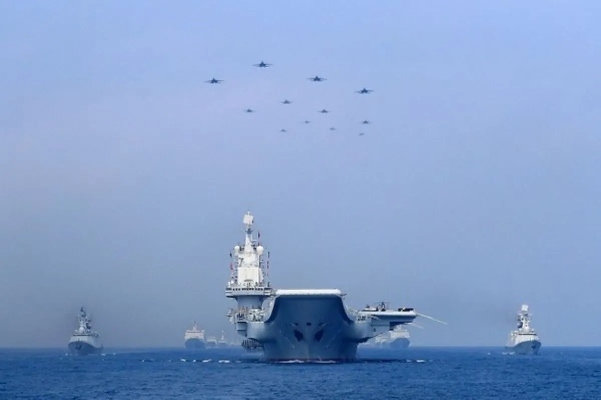
Increased People's Liberation Army Navy (PLAN) patrols and air force sorties around disputed Philippine maritime features represent a calculated escalation from gray-zone coercion to active area-denial conditioning. While surface-level reporting frames sudden surges in naval and aerial activity as preparations for an imminent kinetic blockade or encirclement, operational reality points to a different objective: establishing irreversible administrative and military control inside the Philippines' Exclusive Economic Zone (EEZ) without crossing the threshold that triggers the 1951 US-Philippines Mutual Defense Treaty.
To understand the mechanics of this escalation, observers must separate tactical noise from strategic geometry. Beijing is executing a multi-domain pressure campaign designed to exhaust Philippine resupply logistics, normalize a permanent military presence within the First Island Chain, and test the response latency of treaty allies. If you liked this piece, you should look at: this related article.
Deconstructing the Encirclement Hypothesis
In naval warfare, true encirclement—or a close blockade—requires total sea control and air superiority over a defined littoral zone, backed by the declared intent to intercept, board, or destroy neutral and belligerent vessels. China has not declared a blockade, nor has it deployed the amphibious assault groups required to seize and hold occupied features like Thitu Island (Pag-asa) or Second Thomas Shoal (Ayungin).
What is actually occurring is cordon-and-squeeze operations. This operational concept relies on concentric rings of assets to restrict maneuverability while preserving plausible deniability. For another look on this development, check out the latest update from TIME.
- The Inner Ring (Paramilitary Attrition): The China Coast Guard (CCG) and the People's Armed Forces Maritime Militia (PAFMM) occupy the immediate approaches to Philippine-held shoals and reefs. Equipped with reinforced hulls, high-pressure water cannons, and Long-Range Acoustic Devices (LRADs), these vessels conduct blocking maneuvers, rammings, and swarming tactics. Their function is physical interdiction below the threshold of conventional armed attack.
- The Middle Ring (Naval Overmatch): PLAN frigates, destroyers, and corvettes loiter just beyond the visual horizon—typically 12 to 24 nautical miles from the contested feature. These gray-hull warships rarely engage directly in collisions. Their presence serves as an escalatory backstop, signaling to the Armed Forces of the Philippines (AFP) that any kinetic retaliation against the CCG will immediately meet conventional naval firepower.
- The Outer Ring (Aerial Intelligence and Strike): People's Liberation Army Air Force (PLAAF) and PLAN Aviation assets—including J-11 and J-16 fighters, H-6K bombers, and WZ-7 high-altitude reconnaissance drones—conduct persistent patrols overhead. This aerial umbrella provides real-time targeting data, enforces an informal Air Defense Identification Zone (ADIZ), and intimidates Philippine maritime patrol aircraft conducting drops to isolated outposts.
The Strategic Geometry of the First Island Chain
Why does Beijing accept the diplomatic cost of aggressive patrols near Palawan and Luzon? The answer lies in the geography of the First Island Chain—the archipelago stretching from the Kuril Islands through Japan, Taiwan, and the Philippines down to Borneo.
For the PLA, the South China Sea is not merely a dispute over hydrocarbon reserves or fishing rights; it is a vital bastion for its sea-based nuclear deterrent. Bastion strategy requires insulating the deep waters of the South China Sea—where Jin-class (Type 094) ballistic missile submarines operate—from anti-submarine warfare (ASW) networks operated by the United States and its allies.
If the Philippines expands access to its bases under the Enhanced Defense Cooperation Agreement (EDCA)—specifically sites in Northern Luzon facing the Luzon Strait and on Palawan facing the Spratly Islands—the US military gains prime staging grounds to bottle up the PLAN inside the South China Sea during a Taiwan contingency.
By saturating the maritime and air approaches to the Philippines now, Beijing aims to achieve two operational goals:
- Degrade Outpost Sustainability: Force Manila to expend disproportionate fuel, maintenance hours, and political capital just to rotate troops and deliver basic rations to remote garrisons like the grounded BRP Sierra Madre.
- Map Allied Response Curves: Every surge in PLAAF sorties and PLAN deployments forces the AFP and US Indo-Pacific Command (INDOPACOM) to activate radar networks, scramble interceptors, and adjust satellite coverage. Beijing systematically logs these electronic signatures and reaction times to refine its electronic warfare and suppression of enemy air defenses (SEAD) battle plans.
Mechanics of Air-Sea Coercion
The integration of naval and air patrols marks a distinct shift from earlier phases of the South China Sea dispute, which relied heavily on island-building and isolated coast guard standoffs. Synchronized air-sea activity introduces complex operational dilemmas for Philippine commanders.
Acoustic and Electromagnetic Saturation
When PLAAF surveillance aircraft operate in tandem with PLAN surface combatants, they flood the local electromagnetic spectrum. Radar lock-ons, communications jamming, and spoofed Automatic Identification System (AIS) transponders blind smaller Philippine vessels. This sensory denial increases the risk of navigational error and prevents Manila from documenting Chinese aggression in real time—a critical component of the Philippines' "assertive transparency" strategy.
Airspace Compression
Fixed-wing and rotary aircraft from the AFP face severe operational envelopes when operating over the West Philippine Sea. Chinese fighter jets routinely execute high-speed intercepts, releasing flares or crossing flight paths at unsafe distances. By establishing routine fighter patrols over features like Scarborough Shoal (Bajo de Masinloc)—located just 124 nautical miles west of Luzon—the PLAAF compresses the reaction time available to Philippine air defenses. From Scarborough Shoal, Chinese strike aircraft are within unrefueled combat radius of Manila and major military installations at Clark and Subic Bay.
Logistics Choke Points
Philippine outposts in the Spratly archipelago depend entirely on vulnerable sea lines of communication (SLOCs). A civilian supply boat escorted by two coast guard cutters must traverse hundreds of miles of open water shadowed by larger, faster Chinese vessels. When China surges naval and air patrols simultaneously, it creates a dynamic blockade without firing a shot. The supply convoy faces continuous flank pressure, forcing captains to abort missions to avoid catastrophic hull damage or loss of life.
Known Facts Versus Analytical Hypotheses
Rigorous strategic assessment requires separating verifiable deployments from speculative intent.
Verified Operational Facts:
- Militarized Artificial Islands: Mischief Reef, Subi Reef, and Fiery Cross Reef now host 3,000-meter runways, hardened aircraft shelters, deep-water harbors, and emplaced HQ-9B surface-to-air missile and YJ-12B anti-ship cruise missile batteries. These bases eliminate the tyranny of distance, allowing the PLAN and PLAAF to sustain continuous patrols without returning to mainland China.
- Escalation of Force: Chinese vessels have transitioned from passive presence to active physical interdiction, utilizing military-grade lasers, water cannons capable of shattering bridge glass, and aggressive hull-to-hull collisions against Philippine vessels.
- Increased Air Activity: Frequency of PLA aircraft operating within the Philippine EEZ and approaching the territorial airspace of Luzon has risen measurably alongside joint maritime drills conducted by the US, Japan, Australia, and the Philippines.
Analytical Hypotheses (Unconfirmed Intent):
- Imminent Kinetic Invasion: Claims that current patrols signal an immediate military assault on Thitu Island remain unsupported by amphibious force posture. Seizing fortified islands requires specialized landing craft, heavy logistics ships, and staging concentrations at southern Chinese ports that satellite imagery has not detected.
- Full Maritime Quarantine: While China possesses the physical hulls to seal off Philippine outposts entirely, doing so carries severe strategic risk. Starving Philippine marines on Second Thomas Shoal or shooting down a Philippine transport plane would likely trigger Article IV of the US-Philippines Mutual Defense Treaty, transforming a localized gray-zone advantage into a direct great-power confrontation.
Strategic Friction and Operational Limitations
Beijing’s aggressive posture is not without severe structural vulnerabilities. Applying continuous pressure across a vast maritime theater incurs steep financial, mechanical, and geopolitical costs.
- Hull Fatigue and Maintenance Cycles: Keeping dozens of CCG cutters and PLAN warships on station year-round accelerates mechanical wear in corrosive tropical waters. High operational tempos reduce time for dry-dock maintenance and crew rest, degrading combat readiness over multi-year timelines.
- Counter-Coalition Consolidation: Every aggressive maneuver around Philippine vessels accelerates regional balancing. Manila has responded by deepening defense ties with Tokyo, Canberra, and Washington, securing coastal radar systems, patrol vessels, and joint intelligence-sharing agreements that directly undermine China's long-term goal of isolating the Philippines.
- The Escalation Trap: Decentralized command in tactical standoffs creates high variance. A single miscalculation by a CCG captain or a young PLAAF pilot—resulting in the sinking of a Philippine ship or the death of service members—could strip Beijing of escalation control and force an unwanted military crisis.
Tactical Countermeasures and Strategic Trajectory
Manila and its treaty allies cannot match China hull-for-hull in the immediate littoral zone without risking full-scale war. Neutralizing a cordon-and-squeeze campaign requires asymmetric operational adjustments rather than symmetrical naval buildups.
First, the Armed Forces of the Philippines must shift from predictable, large-convoy resupply runs to distributed, low-signature logistics. Utilizing smaller, high-speed vessels operating under cover of darkness or adverse weather—paired with unmanned aerial cargo drones for critical medical and technical supplies—reduces the target profile and complicates Chinese interception geometry.
Second, counter-coercion requires persistent, multi-sensor domain awareness. Deploying unmanned surface vessels (USVs), long-endurance reconnaissance drones, and commercial satellite constellations ensures that every Chinese hull movement and radar emission is recorded and broadcast globally in real time. Denying Beijing operational secrecy raises the diplomatic cost of every aggressive maneuver.
Third, Manila must accelerate the hardening and dispersion of its coastal anti-access/area-denial (A2/AD) architecture. Integrating land-based anti-ship missile batteries (such as the BrahMos system) along the western coast of Luzon and Palawan holds Chinese surface combatants at risk without requiring the Philippine Navy to win a direct surface engagement. When PLAN destroyers operating in the middle ring face credible shore-based missile threats, their ability to act as an unchallenged escalatory backstop diminishes sharply.
Beijing will continue to test the boundaries of gray-zone coercion, using surges in naval and air patrols to normalize its presence and probe allied resolve. The outcome of this campaign will not be decided by a single dramatic naval battle, but by which side sustains its logistical, technological, and alliance endurance over the next decade.