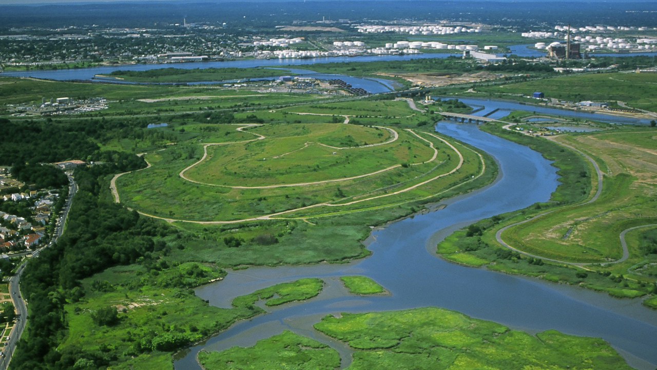
Traditional municipal engineering models suffer from a fatal structural flaw: they treat urban precipitation as an enemy to be evacuated immediately through subterranean concrete channels. This grey infrastructure paradigm relies on linear capital expenditure scaling, where every acre of impervious surface added to a municipality requires a proportional expansion of underground pipe networks, retention basins, and energy-intensive pumping stations. When precipitation events exceed the hydraulic capacity of these closed systems, failure is absolute, resulting in street-level flooding and unmitigated ecological discharge.
The structural alternative deployed across the southern watersheds of Staten Island in the 1990s, formalized as the Bluebelt program, rejected this linear cost function. By integrating existing freshwater wetlands, natural streams, and ponds into the municipal drainage network, city planners decoupled stormwater management from endless concrete procurement. This approach yields a blueprint for municipal capital allocation that prioritizes distributed ecological absorption over centralized mechanical conveyance.
The Cost Function of Grey Versus Green Engineering
To understand why conventional storm sewers generate systemic municipal debt, one must examine the capital expenditure (CapEx) and operating expenditure (OpEx) curves of underground concrete networks. Standard municipal drainage relies on subterranean trunk sewers that require deep excavation, disruption of existing urban layouts, and massive capital outlays upfront. As urban density increases, the volume of runoff scales linearly with impervious surface coverage, forcing municipalities into an escalating cycle of infrastructure replacement and capacity upgrades.
The Bluebelt strategy altered this economic model through asset substitution. Instead of acquiring easements to bury concrete pipes, the New York City Department of Environmental Protection utilized targeted land acquisition to purchase strategic wetland parcels along natural drainage corridors.
- CapEx Reduction: Procuring vacant or low-value wetland parcels required significantly lower capital per square foot than deep-earth tunneling and pipe-laying operations. This initial substitution generated direct capital savings exceeding eighty million dollars compared to traditional trunk sewer estimates.
- OpEx Optimization: Concrete infrastructure degrades under hydraulic scour, chemical corrosion, and shifting soil loads, demanding continuous maintenance and structural rehabilitation. Conversely, self-regulating biological systems utilize natural sedimentation and vegetative filtration, distributing maintenance requirements across biological growth cycles rather than heavy mechanical intervention.
Hydrological Mechanics of Distributed Retention
The operational efficacy of a natural drainage network depends on velocity attenuation and volumetric storage. Impervious urban surfaces accelerate runoff velocity, concentrating peak flows into narrow windows that overwhelm treatment plants and stream banks. The Staten Island model counters this dynamic through the strategic placement of Best Management Practices at the interface where conventional street sewers empty into open spaces.
These engineered control points include outlet stilling basins, sand filters, and micropools that slow incoming water velocity before it enters the main wetland body. By forcing high-velocity street runoff to disperse across shallow, vegetated basins, the system converts kinetic energy into potential storage. The water spreads laterally across the floodplain, dropping suspended particulates and heavy metals out of the water column through natural sedimentation.
In flat topography prone to tidal influences, where tide gates close during high-tide events to prevent backflow from surrounding bays, traditional pipe networks quickly back up and flood adjacent intersections. The Bluebelt framework resolves this hydraulic bottleneck by utilizing broad wetland footprints as temporary holding reservoirs. These open basins store massive volumes of stormwater during peak tidal lock periods, releasing the water gradually only after outgoing tides reopen the discharge routes.
Regulatory Integration and the Risk of Systemic Under-Capacity
Transitioning from mechanical conveyance to biological management requires stringent legal and zoning frameworks. Natural drainage corridors are vulnerable to speculative real estate development and private infill construction, which can fragment continuous watersheds and compromise hydraulic performance. Municipalities attempting to replicate this model must establish rigorous zoning overlays, clear wetland mapping, and strict no-net-loss mandates to protect headwater streams from being paved over.
However, decentralized green infrastructure introduces distinct operational vulnerabilities that must be actively managed:
- Nutrient Loading: Urban runoff carries nitrogen, phosphorus, and hydrocarbon residues from vehicular traffic. Without adequate upstream vegetative filtering, excessive nutrient loading triggers eutrophication within urban ponds, depleting dissolved oxygen and destabilizing the local ecosystem.
- Capacity Boundaries: Extreme precipitation events driven by shifting climate patterns can saturate biological storage limits. Green infrastructure cannot completely replace heavy grey engineering; it requires an optimized hybrid architecture where retention wetlands are paired with targeted detention facilities and overflow controls to handle extreme volume spikes.
- Maintenance Precision: Unlike closed pipes that operate out of sight, biological systems require skilled ecological stewards. Invasive plant species can choke out native water-filtering vegetation, reducing the hydraulic roughness and storage capacity of the wetland corridors.
Strategic Deployment Blueprint for Municipal Infrastructure
Municipalities evaluating legacy drainage deficits must implement a staged transition framework to capture the economic and ecological efficiencies demonstrated by distributed wetland integration.
- Watershed Topographical Audit: Map all natural historical drainage paths, identifying remaining unpaved depressions, low-lying parcels, and stream corridors currently constrained by subterranean piping.
- Land Acquisition Prioritization: Secure strategic parcels along headwaters and floodplains before urban land values appreciate or development isolates the parcels from the primary drainage network.
- Interface Engineering: Construct localized Best Management Practices at the precise junctions where municipal street gutters transition into open green spaces, controlling velocity and capturing coarse sediment before it enters the main ecosystem.
- Hybrid Capacity Calibration: Design retention capacities based on local rainfall frequency curves, pairing open wetland storage with strategic mechanical overflow structures to ensure system resilience during extreme storm surges.