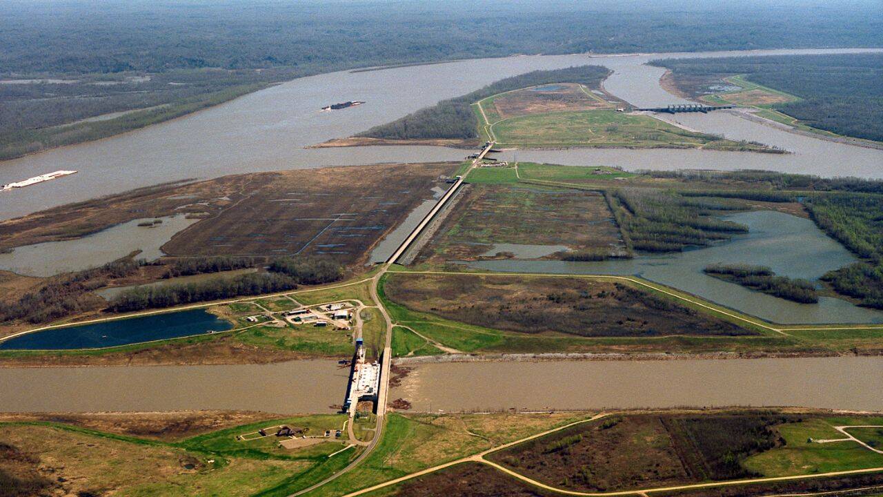
Engineering interventions on dynamic hydrological systems generate predictable unintended consequences when static infrastructure meets a fluid geomorphologic baseline. The deployment of nearly 2,000 kilometers of levees along the Mississippi River represents a classic optimization failure: maximizing immediate flood control for navigation and riparian real estate while systematically starving the deltaic plain of the sediment necessary to maintain surface elevation against relative sea-level rise. This operational trade-off transformed the lower basin into a sediment pipeline, funandering millions of metric tons of particulate matter past the continental shelf and directly into the deep Gulf of Mexico instead of permitting periodic, lateral distribution across adjacent wetlands.
Understanding the mechanics of deltaic degradation requires analyzing the fundamental equation governing coastal land preservation. Elevation maintenance depends on a delicate equilibrium between vertical accretion through mineral and organic sediment deposition, and vertical subsidence driven by compaction, oxidation of organic soils, and eustatic sea-level rise. When levees confine the river within a narrow, high-velocity channel, suspended sediment is no longer deposited on the floodplain during overbank flow events. Without this annual influx of mineral mass, the surface elevation of the wetlands drops below mean sea level as underlying strata compact. The physical removal of the natural overflow mechanism turns a self-healing land-building apparatus into a land-loss engine.
The hydraulic architecture of the system ensures that sediment remains suspended until it reaches the terminus of the artificial channel. Natural river basins distribute particulate loads through a network of distributary channels and crevasse splays, slowing water velocity and dropping sediment load across broad geographic footprints. Channelization accelerates flow parameters, exceeding the threshold velocity required for particle settlement across the coastal zone. This hydraulic efficiency successfully prevents local inundation during high-water events but eliminates the depositional budget required to offset natural geological subsidence rates, which range from five to over ten millimeters per year in specific coastal parishes.
Evaluating the true cost function of channelization involves accounting for the permanent loss of ecological buffers that protect inland infrastructure from marine storm surges. Coastal wetlands function as natural frictional barriers, attenuating wave energy and reducing storm surge heights during tropical weather events. Every square kilometer of marshland converted to open water via erosion and submergence reduces this frictional resistance, exponentially increasing the vulnerability of coastal population centers and industrial corridors. Consequently, the capital expenditure dedicated to building and maintaining higher levees creates an escalating financial and engineering feedback loop, requiring ever-taller defensive structures to protect land that is sinking precisely because those structures exist.
Restoring functionality to a heavily engineered system demands a strategic shift from passive structural defense to active sediment redirection. The primary mechanism for halting further land loss involves the construction of controlled sediment diversions, strategically placed cuts in the levee network designed to capture a fraction of the river's water and sediment load and discharge it into adjacent shallow basins. These diversions mimic the historical crevasse splay process, artificially recreating the conditions necessary for land building. However, designing these interventions introduces severe operational friction: diverting sediment-rich water away from the main navigation channel increases local shoaling, requiring expensive, continuous dredging to maintain the commercial draft depths demanded by maritime shipping interests.
Navigating this operational stalemate requires prioritizing long-term geomorphologic recovery over short-term navigational convenience. Sediment diversion projects must be calibrated to match the natural seasonal hydrograph of the river, capturing high-discharge pulses when sediment concentrations peak while minimizing saltwater intrusion during low-flow periods. At the same time, basin managers must integrate thin-layer placement of dredged material across degraded marshes to artificially accelerate vertical accretion while waiting for natural depositional processes to take effect.
The structural degradation of the Mississippi River delta illustrates the limits of command-and-control environmental engineering. Long-term stabilization of deltaic landmasses cannot be achieved through higher walls and deeper channels alone. Regional strategy must treat the river not as a static drainage pipe, but as a dynamic sediment delivery system, accepting the operational friction of managed flooding as the non-negotiable cost of maintaining a viable coastal geography.