Structural Vulnerabilities in Wildfire Response Frameworks
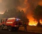
Wildfire suppression strategies routinely fail because operational response protocols treat ignition, propagation, and evacuation as linear sequential events rather than interconnected dynamic feedback loops. When rapid environmental shifts occur—specifically the convergence of low relative humidity, high fuel loads, and sustained high-velocity winds—the window between ignition and critical threat capacity collapses. Mass evacuations exceeding 20,000 individuals represent a systemic boundary failure: the moment where suppression assets lose tactical control, shifting the entire operational objective from fire containment to force preservation and life safety.
Understanding the mechanics of large-scale emergency displacements requires evaluating three core variables: fuel moisture deficit, thermal transport rate, and egress throughput limits. When a fire front breaches critical containment thresholds, emergency infrastructure faces an exponential load spike. Evacuation corridors designed for routine traffic capacities become single points of failure under panic conditions, directly threatening human safety and stalling operational logistics.
Fuel Dynamics and Rate of Spread Physics
Wildfire propagation relies on fuel structure, microclimate conditions, and topography. Fire line intensity determines whether direct suppression—such as ground crew installation of handlines or direct water drops—remains viable.
Critical Intensity Threshold = Fuel Consumption Rate × Heat Content × Rate of Spread
Direct attack mechanisms generally fail when fire intensity exceeds 2,000 kW/m, a value frequently surpassed during extreme drought events combined with severe wind conditions.
Thermal Radiation and Spotting Mechanisms
The primary accelerator of sudden wildfire escalation is indirect ignition through convective embers, widely known as spotting. Spotting breaks established containment lines through two distinct physics mechanisms:
- Short-Range Convection: Heavy thermal updrafts lift burning material, dropping embers tens to hundreds of meters ahead of the main fire front. This converts a single continuous line into a multi-front complex.
- Long-Range Transport: High-altitude plume dynamics carry lightweight fuels kilometers downstream. Ember showers land in unburned vegetation or residential structures, initiating secondary ignition zones that force immediate regional evacuations.
When ember density crosses a critical threshold, resource allocation splits. Emergency services must choose between defending primary containment boundaries or protecting isolated structures within secondary ignition zones. Strategic prioritization almost always shifts to life preservation, forcing abandons of suppression lines and triggering sudden mass evacuation directives.
The Logistics of Rapid Population Displacement
Executing an evacuation of over 20,000 citizens in short timeframes requires managing non-linear logistical bottlenecks. Egress routes function as strict queue systems subject to flow degradation under stress.
Egress Throughput Constraints
The capacity of a transportation network drops significantly as vehicle density approaches structural limits. The primary bottlenecks during emergency evacuations stem from three structural vulnerabilities:
- Capacity Shock: Sudden spikes in vehicle volume exceed maximum lane capacity (typically 1,900–2,200 vehicles per lane per hour under ideal conditions), causing flow velocity to drop toward zero.
- Directional Imbalance: Traditional road networks allocate lane capacity symmetrically. Emergency operations must implement contraflow systems to double outbound capacity, requiring significant law enforcement coordination and clear traffic control assets.
- Smoke-Induced Visibility Reduction: Particulate density reduces driver velocity, compounding traffic density and increasing the probability of collisions that block primary exit corridors entirely.
Total Evacuation Clearance Time = (Population Volume / Network Flow Capacity) + Route Hazard Delay
If the calculated clearance time exceeds the estimated arrival time of the fire front, loss of life risks escalate dramatically.
Resource Allocation Paradoxes in High-Intensity Incidents
During mass displacement events, incident commanders confront severe resource constraints. Personnel, air assets, and structural protection units cannot deploy simultaneously across all fire boundaries.
Tactical Trade-offs
- Direct Suppression vs. Corridor Protection: Diverting water-dropping aircraft to cool critical evacuation routes reduces the air assets available to knock down the primary fire head.
- Perimeter Defense vs. Tactical Retreat: Maintaining firebreaks near residential edges becomes untenable when radiative heat fluxes threaten responder survival, forcing crews to fall back and forfeit defensive positions.
- Communications Failures: Cellular network saturation or infrastructure destruction rapidly degrades real-time situational awareness, delaying evacuation orders and creating localized panic traps.
Command structures must utilize clear decision trees, prioritizing human egress routes over structure defense until population movement clears high-risk zones.
Operational Blueprint for Integrated Wildfire Resiliency
To prevent catastrophic system overrides during extreme fire events, regional disaster management bodies must transition from reactive displacement models to predictive infrastructure design.
Structural Fuel Management
Mitigating wildfire escalation requires continuous fuel load reduction within the Wildland-Urban Interface (WUI). Strategic vegetation management involves selective thinning, systematic prescribed burns during low-risk seasonal windows, and enforcing defensive space standards around residential structures. Reducing fuel continuity suppresses fire intensity below critical operational thresholds, keeping direct attack options viable longer.
Dynamic Traffic Routing Systems
Evacuation planning must replace static evacuation maps with adaptive traffic management algorithms. Deploying real-time monitoring assets—such as infrared drone mapping paired with automated cellular alert networks—allows emergency managers to direct traffic dynamically away from expanding ember zones. Early implementation of contraflow lanes on major arteries doubles outbound capacity before vehicle accumulation triggers severe network stalls.
Civil defense agencies must embed these logistical and physics-based models into real-time operational command frameworks rather than relying on reactive emergency declarations after perimeter breach occurs.

/https://i.s3.glbimg.com/v1/AUTH_e84042ef78cb4708aeebdf1c68c6cbd6/internal_photos/bs/2026/g/B/3vpkvHQKizRKAfzDxjXA/vini-jr-antes-e-depois.jpg)