When a quarter-square-mile slab of high-altitude ice sheered off a Himalayan peak at 5,200 meters, it did not merely fall. It detonated.
The catastrophic flash flood that roared down the Nepal-Tibet border along the Lhende Khola, Bhotekoshi, and Trishuli river systems materialized with terrifying speed. Official assessments from Beijing and Kathmandu point squarely to a massive high-altitude glacial collapse as the prime driver of the disaster. Yet, attributing hundreds of deaths and thousands of missing persons solely to a sudden block of ice breaking loose oversimplifies a complex and escalating crisis along the roof of the world.
The mechanics of the event defy ordinary intuition. High-resolution satellite analysis reveals that an immense mass of ice and rock dropped roughly 1,200 vertical meters into the valley floor below. That kinetic impact instantly pulverized the frozen debris, flash-melting tons of snow and ice while simultaneously scooping up loose sediment.
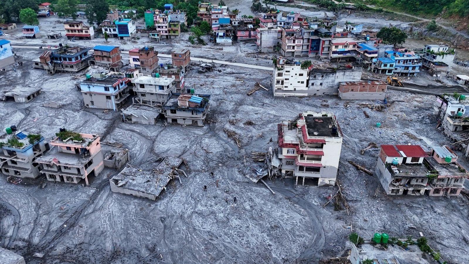
Water mixed with rock and soil behaves differently than standard river overflow. Hydrologists classify the resulting torrent not as water, but as a debris flow resembling liquid concrete. Moving at highway speeds through steep mountain gorges, this slurry bulked up in volume with every bend in the river. It temporarily choked the narrow channels, forming unstable natural landslide dams that inevitably breached under immense hydrostatic pressure. When those temporary barriers failed, they unleashed secondary shockwaves downstream into populated valleys and vital infrastructure nodes like the Gyirong border post.
For years, regional specialists have warned that the Hindu Kush Himalayan range is warming at roughly twice the global average. That thermal anomaly accelerates the thinning of glacial tongues, destabilizes internal moraines, and leaves thousands of high-altitude cubic meters of ice hanging precariously over steep topography. While politicians in Beijing and Kathmandu coordinate emergency search-and-rescue operations for hundreds of missing locals and foreign tourists, the scientific reality demands a harder look at transboundary early warning systems.
Mountain ecosystems do not recognize political boundaries. A collapse originating on the Nepalese side of the high frontier cascades instantly into autonomous regions of China, battering shared watersheds and trapping communities before sirens can sound. Traditional monitoring methods rely heavily on downstream stream gauges. By the time a gauge registers a twenty-foot spike in river height, the liquid concrete has already arrived.
Mitigating future catastrophes requires shifting focus upward to the glacial source zones themselves. Remote sensing, continuous satellite radar interferometry, and real-time seismic monitoring of ice movements must become standard operating procedure across the Himalayas. Until regional governments prioritize shared, high-altitude telemetry over reactive disaster management, valleys downstream will remain vulnerable to the next silent mountain slope waiting to give way.